Our interactive map gets a makeover!
Tom Reed, 19/05/2021
To all users of the Ancient Tree Inventory,
We have some interesting new updates coming to the Ancient Tree Inventory map very soon and so I wanted to let you know about these before they go live (the changes are to to take effect by the end of May).
New pin colours and icons for the ATI map:
The biggest visual upgrade that you will notice on the map is the new pin design. This has changed both the pin colours and the pin shapes - please scroll down for images and more information.
Why have we changed the colour system?
The current design features red and blue tree symbols which relate to the private/public access status of the tree, with an “A”, “V” or “N” symbol to indicate that a tree is ancient (A), veteran (V) or notable (N).
However, under the previous system one of the biggest visual features of the map was the differences in access status. We wanted to design a new system that would allow users to still be able to identify access status, but that would also help users to quickly identify trees with a different veteran status with more ease.
The new marker-style pin shape will also help us to plot the locations of trees with more precision, as the new design now has a distinct point which users should aim to position on top of the centre of the tree canopy where possible.
The new ATI symbol design displays trees on both their access status and now with veteran status by colour instead of by a letter symbol.
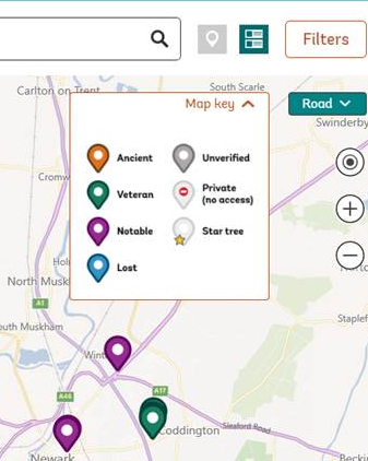
The map key showing new symbol design. Orange = ancient, Green = veteran, Purple = Notable, Lost = Blue and Grey = Unverified
With the new colour scheme, ancient, veteran and notable trees are given a different colour:
Ancient = Orange
Veteran = Green
Notable = Purple
Lost = Blue
Grey = Unverified
How will access status be displayed?
In each pin there is a white circle. If this circle is BLANK the tree has PUBLIC access status, but if the tree features a RED “NO ENTRY” SYMBOL then this indicates that the tree falls under PRIVATE access (this includes Private – visible from public access).
With the previous design, the colour scheme focused on access status. However, this made it less easy to visualize the veteran status of a tree, especially when dealing with a group of trees. Since veteran status is such a crucial piece of information to all users of the site, we wanted to make sure that this information could be displayed in a user-friendly way.
Overall, the new design will help you to quickly see the access status and veteran status of an individual tree, whilst also bringing extra benefit to those using the map to compare veteran status at a regional scale too.
See the examples below which demonstrate the differences between the current pins and the new pin scheme.
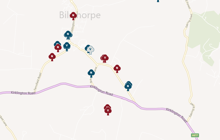
The previous map symbols
The new map symbols
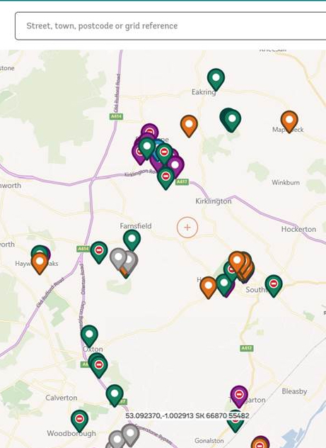
Find grid references instantly
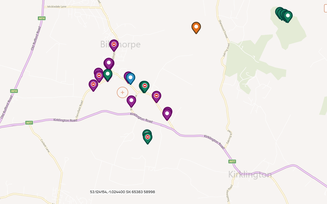
A new useful feature of the main map will be the addition of a permanent grid reference and latitude/longitude reading at the base of the map.
As you pan around the map, you will see that the coordinates change, giving you the option to read the exact coordinates straight from the main map. There is a faint cross-hair that stays permanently in the centre of the map; this is where your coordinates are being read from.
This will give users the option of recording the coordinates of a tree accurately, without the need to use a GPS or a grid reference mobile-app.
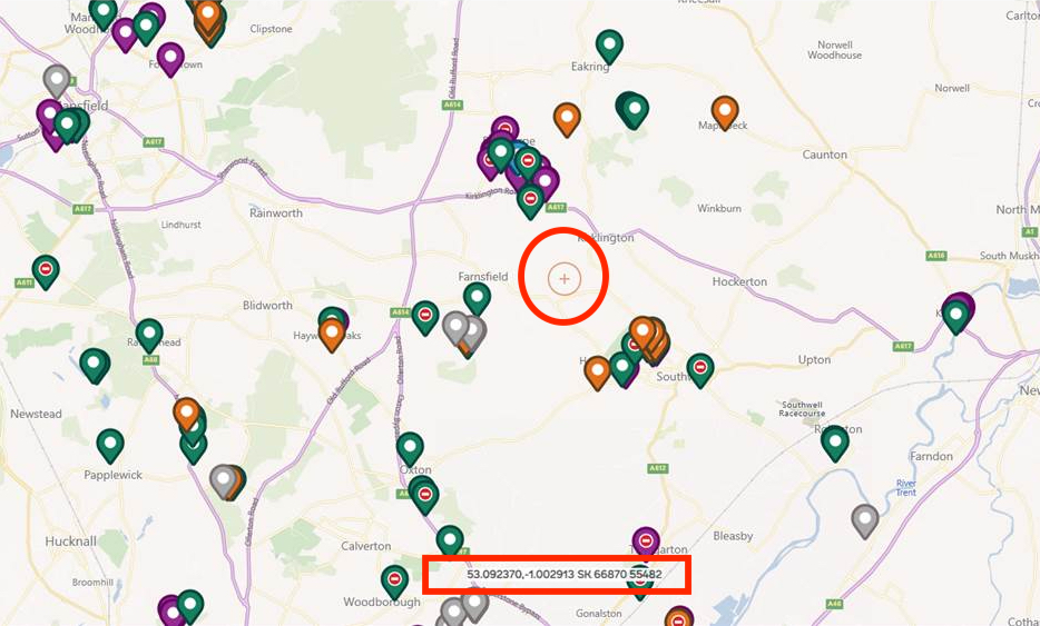
Red rectangle = location of the new coordinate overlay, Red circle = the displayed coordinates will be read based on the position of this faint crosshair. (The red circle and rectangle are not shown on the actual map, they are just in this screenshot).
Full screen map
In the top-left of the map, there will be a button that allows you to open the map full-screen on your device (see red arrow in image below). This will be useful to those wanting to view a wider area of the map e.g. when printing a screenshot, or simply when trying to use the map whilst using a mobile phone outdoors.
Note: at present this feature wont work for iOS devices.
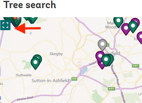
The full-screen button can be found in the top-left hand portion of the map. See red arrow.
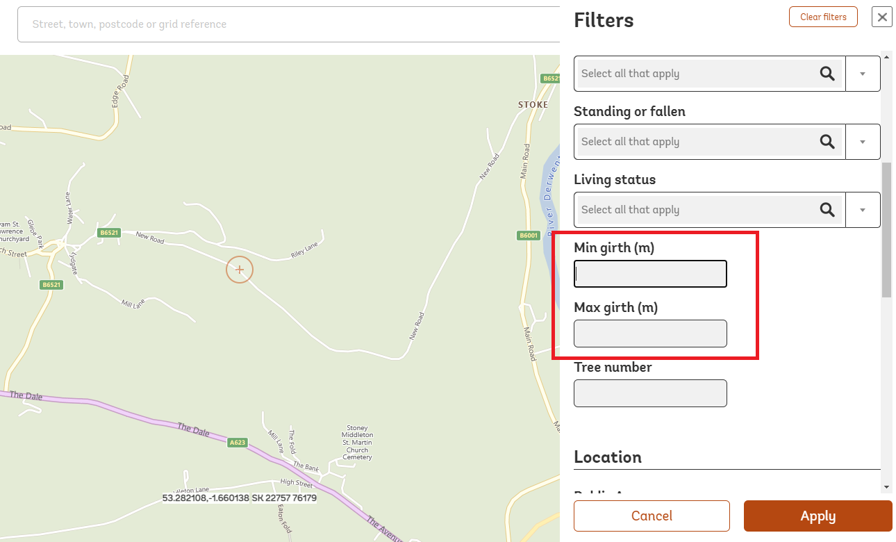
New minimum / maximum girth filters
We will be adding a new filter to the map filters section that allows users to search by minimum / maximum girth. For example, if you wanted to show trees that had a girth greater than 8m, then you could set the minimum girth to “8m” and then press apply.
This will provide an extra way for you to browse and refine your searches from this very large dataset and will be a very useful additional tool for our ancient tree verifiers when targeting unverified records.
To use this feature, all you need to do is click on the orange “filters” button (top right of the main map), click on the “more options” text, and then scroll down to access the new min./max. girth filter.
We hope that these changes bring benefits to all users of the website and help you to record the locations of special trees with more ease.
If you have a query about any of the new features then please get in touch via the “contact us” form.
Best wishes
Tom Reed
Ancient Tree Inventory – Citizen Science Officer